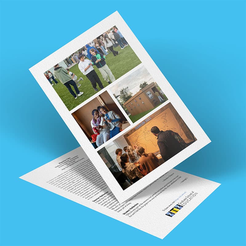
Working in pairs, students conducted research and created idiosyncratic maps depicting familiar aspects of San Diego and were challenged to rethink the reality of the built environment around them. They became more invested in their communities because their new knowledge implicated them as involved citizens. By exhibiting their digital maps in multiple venues, students invited their communities to participate in this project of making San Diego a complex city. Students chose an object of study, devised an essential guiding question, and decided how to communicate their findings in words and symbols (maps). They conducted interviews, bringing community members into the process of knowledge production. Later, students participated in several rounds of peer critique and writers’ workshops to sharpen the message of each map, clarify the accompanying essays, and articulate a critical thread that would link all the maps together for a coherent and provocative end result.
My partner and I created a map comparing the number of banks and check-cashing stores in Logan Heights versus Coronado, two communities in San Diego that are separated only by a bridge. We discovered that Coronado has three times the number of banks as Logan Heights does, yet Logan Heights has double the population of Coronado. After plotting the bank locations on our map and seeing the imbalance, we turned to Dr. Natalia Molina, from UCSD, who helped us understand why. In the past, only white people were allowed to buy in places like Coronado, and minorities could only buy in places like Logan Heights. And businesses, like banks, wanted only to build in white neighborhoods. Over time, Coronado was able to build a solid foundation of economic access. Logan Heights was not, because banks and businesses refused to invest in communities of color. In sum, we believe that the banking imbalance seen today and shown on our map is the legacy of the institutional racism and redlining of San Diego’s past.